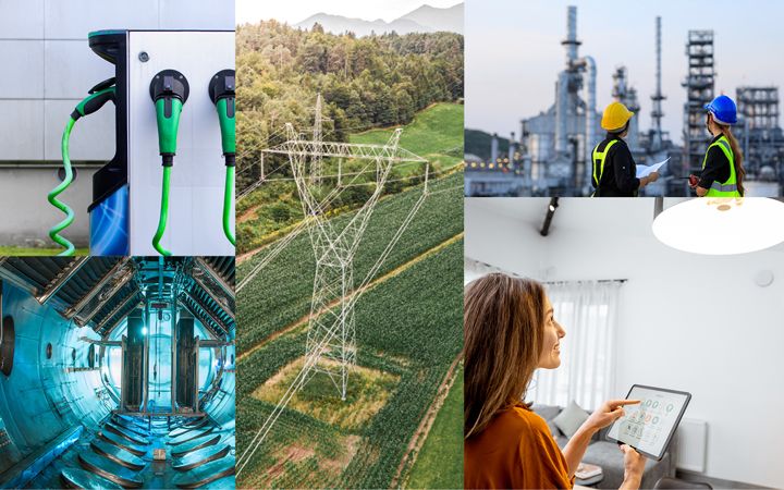
Hawaii uses innovative GIS mapping to build energy infrastructure resilience
We partnered with the Hawaii State Energy Office (HSEO) to conduct a comprehensive hazard and risk assessment of O'ahu’s critical energy infrastructure, resulting in an innovative data visualization tool designed to effectively map and visualize interdependencies and a prioritized plan of risk mitigation strategies.
The Hawaii State Energy Office (HSEO) leads the state's efforts to maintain secure and resilient energy supply. The agency works with its partners to prepare for, and respond to, all threats that could impact Hawaii's energy system.
Challenge
HSEO’s primary goal was to identify key activities for enhancing resilience of the energy system against disruptions. They also wanted to gain a better understanding of the energy infrastructure and answer key questions:
- How does critical infrastructure depend on O'ahu’s energy infrastructure?
- If there is a large-scale event impacting the energy sector, how might the state prioritize restoration to resume essential services?
HSEO wanted to visualize these complex relationships and dependencies through an interactive system for effective disaster mitigation planning and emergency response. This work would then inform the state’s Energy Security Plan and the State of Hawaii Hazard Mitigation Plan, allowing them to plan for key mitigation activities in the years to come.
Solution
ICF engaged stakeholders in O’ahu, including eight energy providers (e.g. electric and gas utilities, refinery, and terminal operators) and many more critical service providers on hazard and risk concerns, back-up power capabilities, interdependencies required for operations, and dependent community lifeline critical infrastructure such as hospitals, emergency services, water supply, wastewater treatment, and vital government buildings. This data collection was instrumental for HSEO to prioritize potential hazard mitigation measures, balancing the needs of major facilities against less critical ones.
In parallel, our climate experts conducted an in-depth analysis to pinpoint the primary hazards (shown in icons, below) impacting the island then determined the threat likelihood for each hazard. Geospatial mapping software was utilized to cross-reference energy infrastructure with hazard probabilities at these O'ahu locations.


Our team also developed an informed vulnerability matrix, enabling HSEO to gauge the impact of various hazards on essential energy infrastructure components. Essentially, the matrix allows us to say: “Given that X hazard is going to happen at Y location, how likely is the facility to be disrupted and to what extent?”
Results
Our Geospatial Decision Support System tool was recognized by the National Association of State Chief Information Officers with the 2024 Emerging & Innovative Technologies Award.
Our technology experts developed a state-of-the-art interactive GIS mapping system. This innovative platform efficiently displays our comprehensive inventory of both energy and essential lifeline infrastructures. Using the information on interdependencies, we assigned a consequence for each piece of energy infrastructure going offline based on the extent of customer impact, especially critical infrastructure customers. The map highlights areas with increased risk of hazard exposure by seamlessly integrating risk scores.
This feature significantly enhanced HSEO's ability to effortlessly identify and focus on areas of heightened concern, streamlining their decision-making process in critical situations. We also developed a complementary interactive portal depicting the intricate relationships between energy infrastructure and key lifeline services. This tool is particularly useful in scenarios like substation failure, revealing the cascading effects on interconnected nodes.
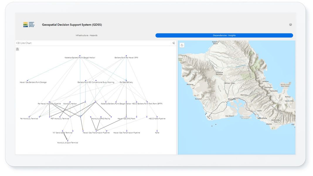
Source: ICF
The interactive systems provide HSEO a tool to continue to prioritize hazard mitigation projects moving forward and quickly understand downstream impacts during emergencies.
We also engaged stakeholders on risk reduction strategies, which led to the identification of 28 prioritized mitigation measures for enhancing energy resilience. The collaborative effort was key to the development of a feasible and actionable hazard mitigation implementation plan that will continue to increase the resilience and reliability of the O’ahu energy system.
Our collective effort with HSEO represents a significant milestone in energy infrastructure assessment and planning. The tools and strategies developed not only empower HSEO in its mission but also set a precedent for proactive and informed energy resilience planning on a regional scale.